


Location SA is the underlying collaboration and infrastructure that supports data sharing throughout government and to the wider community of South Australia. Location SA provides infrastructure and services that support authoritative geospatial data used by both government and the general public.
2020 Winner Public Service Award - Geospatial World Excellence Award
We developed the award winning Location SA Map Viewer to help you:
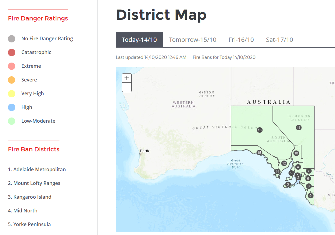
Fire Danger Ratings and Fire Ban Districts Map
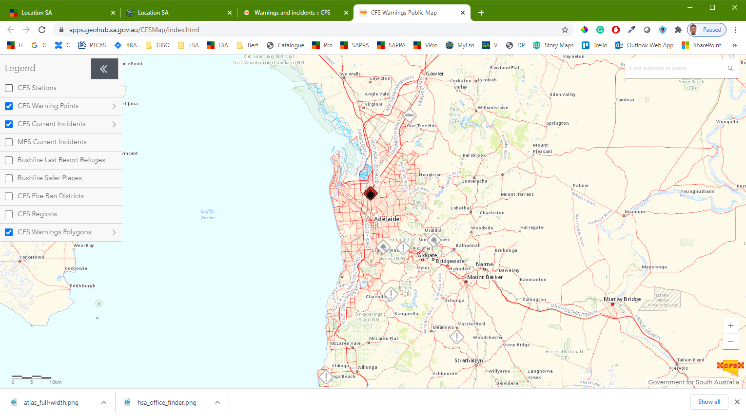
Fire Incidents and Warnings map shows daily and going incidents known to CFS across South Australia.
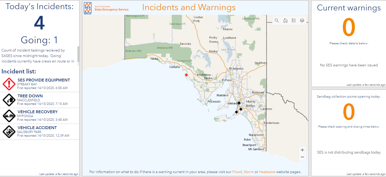
SASES Incidents and Warnings Map shows near real-time information on current SASES warnings, incidents and when available, locations to collect sandbags from.
Emergency related information in the Location SA Map Viewer.

Cycle Instead helps you plan cycling journeys along roads, paths and bikeways in Adelaide.
![]()
Traffic SA helps you identify roadworks, incidents & planned events impacting traffic in South Australia.
![]()
ITLUP helps you understand South Australia’s Integrated Transport and Land Use Plan.

Ravnet helps you find approved heavy vehicle route networks in South Australia.
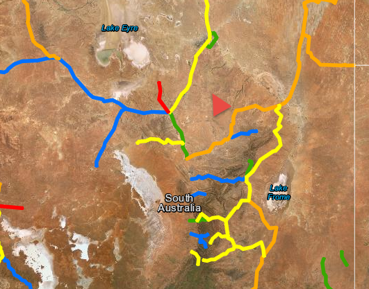
Outback Road Warnings identifies South Australian outback roads temporary closures, restrictions and warnings for various vehicle types.
More in the Location SA Map Viewer:
Find a school or pre-School helps you find which preschool catchment area or school zone you live in or the closest schools.
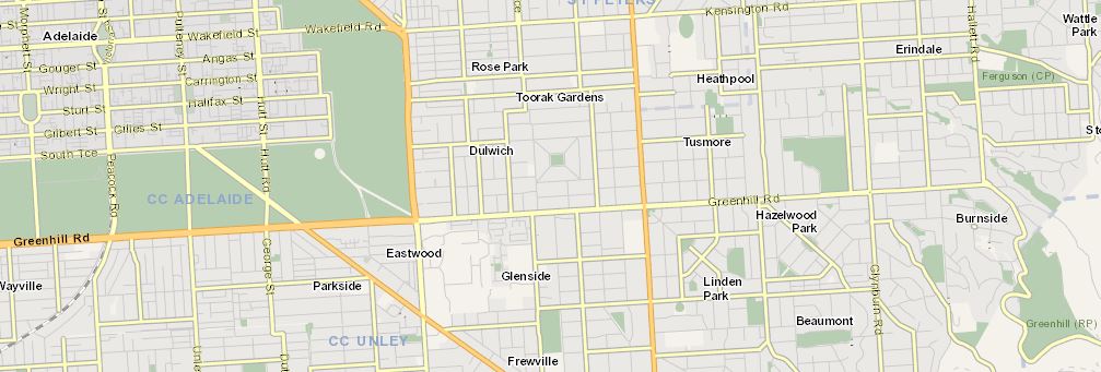
SA Property and Planning Atlas helps you get to information about property developments, place names, survey marks, land parcels and administrative boundaries in South Australia.
![]()
Heritage Portal helps you find protected places and objects of South Australian state and local heritage.
![]()
Sanitary Drainage Plans map helps you find your properties sanitary drainage plans or helps a plumber to lodge plans.
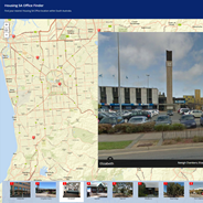
Housing SA Office Finder Map helps you find your nearest Housing SA Office location in South Australia.

Nature Maps helps you to support the management of South Australia’s natural resources.
![]()
Water Connect helps you find South Australia's water resources information with direct access to water-related publications and data.
SA Water Works and Faults Map helps you report faults and see updates on reported water connection works and faults.
EPA Regulated Activities shows regulated Environment Protection Authorities licensed activities around the state.
Urban Heat and Tree mapping Viewer enables the exploration of high-resolution surface temperature data for the Adelaide metropolitan area.
![]()
Aginsight helps you to identify agricultural business opportunities and commodity options in South Australia.
![]()
South Australian Resources Information Gateway (SARIG) helps you to unlock South Australia’s resources, energy and renewables by providing global access to key geoscience information, infrastructure, production statistics, mining and exploration project information.
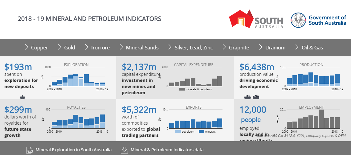
Mineral and Petroleum Industry Indicators dashboard demonstrates mineral and petroleum indicators for South Australia.
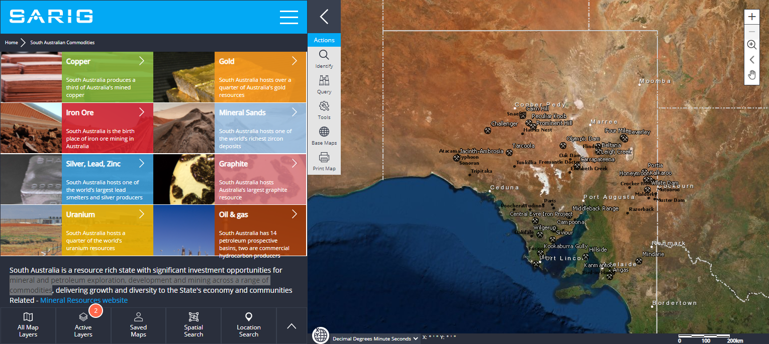
South Australian Commodity Dashboard shows you the significant investment in mineral and petroleum exploration, development and mining across a range of commodities in South Australia.

South Australia’s Renewable Energy Atlas shows locations with ideal conditions to deploy wind and solar projects. It also identifies the location of existing renewable energy projects and South Australia's electricity transmission network and power plants.
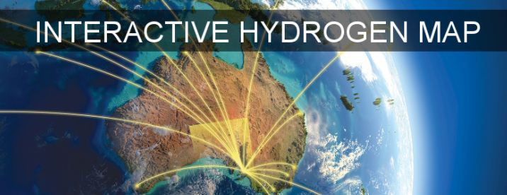
Interactive Hydrogen Map assists investors and project developers to identify potentially suitable sites in South Australia to deploy hydrogen production, transport and utilisation.
Australian Renewable Energy Mapping Infrastructure helps developers and financiers evaluate spatial renewable energy information to support deployment of bioenergy projects.
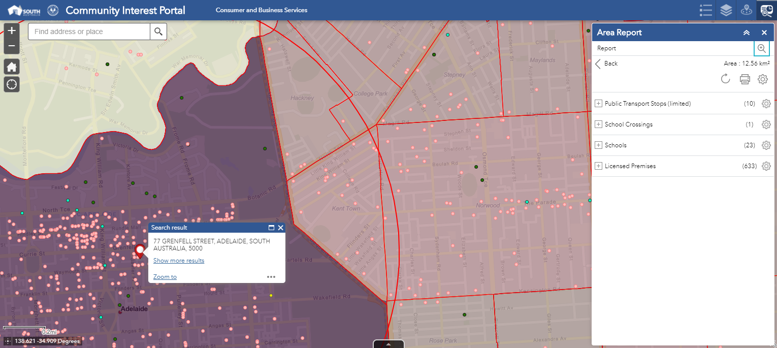
Community Impact Assessment Portal assists licensees in collating the information required to complete a community impact submission for a licensed venue.
Contact us to ask how else we can help you: locationsa@sa.gov.au

The Power of Place - better information, better decisions, better outcomes